|
|
|
Logs On A Map |
|
When
used with a GPS, CQ/X logs
the coordinates of each
QSO
in a file separate from the QSO log. Once the QSO party is over, and
the log submission deadline is past, this
log can be used to create a unique searchable view of the mobile
operation showing
the map location
from which each QSO was made. Creation of a log on a map for
your operations is described briefly
on the
features page
and in
more detail in the Create
Logs on a Map
document
which can be downloaded from the documentation
page.
The screen shot below shows an example wherein the blue pushpins represent all QSOs and the red ones the QSOs of the selected station, in this example DL3DXX. This link will take you to the live log on a map where you can choose a QSO party operation from some examples from the operations of NO5W/M over the last several years. Choose an operation and then select a call of interest from the available calls to see all of the locations from which the selected station was worked. If you're interested in the scenery at the point of the QSO click on the Street View button. 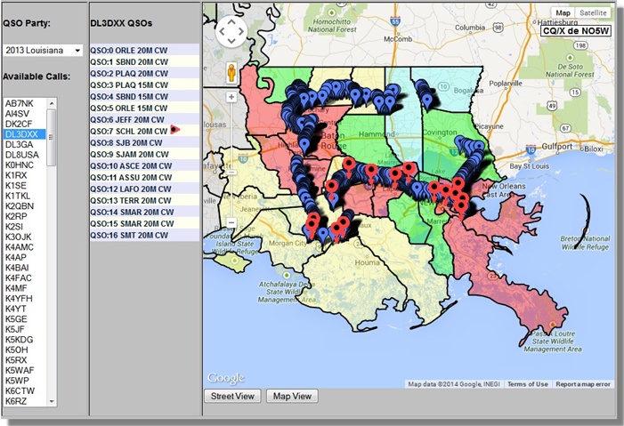 Copyright: C.W. Sanders, NO5W Last Updated: 16-January-2013 |